 Back
BackSearch
Now showing items 11-20 of 308
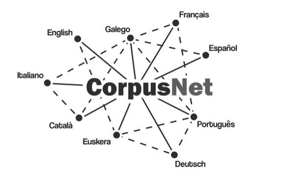
Red de Excelencia CorpusNet. Corpus y Networking: consorcio de proyectos para la gestión de recursos multilingües y sus aplicaciones
(2017)
[EN] CorpusNet is a hub of bilingual and multilingual corpora and related resources featuring any of the languages of Spain (Spanish, Catalan, Galician and Basque) alongside other languages. Its mission is threefold: a) ...
Knowledge co-production and transdisciplinarity: Opening Pandora's box
(MDPI, 2019)
This Special Issue aims to reflect on knowledge co-production and transdisciplinarity, exploring the mutual interaction between water governance and water research. We do so with contributions that bring examples from ...
The natural capital accounting opportunity: Let s really do the numbers
(Oxford University Press, 2018)
Free satellite data key to conservation
(AAAS, 2018)
We agree with Larkin et al. 2019: Restoration is context specific
(Royal Society B-Biological Sciences, 2019)

Software for transferring fiducial marks (v. 1.0)
; Valle Melón, José Manuel  (Laboratorio de Documentación Geométrica del Patrimonio (LDGP), 2005)
(Laboratorio de Documentación Geométrica del Patrimonio (LDGP), 2005)
[EN] Some old photogrammetric digital stereoplotters need fiudicial marks at the corners in order to calculate the interior orientation. The software is aimed for scanned film photographs and draw the fiudicial marks on ...
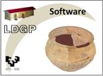
Software to generate VRML models of pottery items (v. 1.0)
; Valle Melón, José Manuel (Laboratorio de Documentación Geométrica del Patrimonio (LDGP), 2005)
(Laboratorio de Documentación Geométrica del Patrimonio (LDGP), 2005)
[EN] The software generates a 3D model in VRML from the profile of a piece of pottery, it allows to include handles and photographic textures.
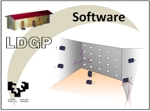
Software for photogrammetric self-calibration (v. 1.0)
(Laboratorio de Documentación Geométrica del Patrimonio (LDGP), 2002)
[EN] This software automatically serches the targets (white dots on a black surface) and
computes both 3D target coordinates and camera (internal and external) orientation.
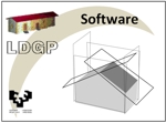
Software for photogrammetric modelling (v. 2.0)
(Laboratorio de Documentación Geométrica del Patrimonio (LDGP), 2003)
[EN] The scope of this software is to obtain 3D virtual models in VRML from a set of photographs (taken one by one) and points of known coordinates defining planes.
LDGP_Scan. Tools for the processing of point clouds
; Valle Melón, José Manuel (Laboratorio de Documentación Geométrica del Patrimonio (LDGP), 2007)
(Laboratorio de Documentación Geométrica del Patrimonio (LDGP), 2007)
[EN] A group of tools is presented that can work with files containing point clouds and generate some cartographic outputs.