 Back
Back[R_Enciso_Castillo] Documentación geométrica del torreón superior, de planta prismática, del castillo de Enciso, La Rioja
| dc.contributor.author | Rodriguez-Miranda, Alvaro | |
| dc.contributor.author | Valle Melón, José Manuel  | |
| dc.coverage.spatial | Castillo de Enciso (Enciso) | |
| dc.coverage.spatial | Enciso, La Rioja, España/Spain (Getty TGN: 7333973) | |
| dc.date.accessioned | 2022-03-30T15:36:17Z | |
| dc.date.available | 2022-03-30T15:36:17Z | |
| dc.date.issued | 2022-01 | |
| dc.identifier.citation | Laboratorio de Documentación Geométrica del Patrimonio (Universidad del País Vasco-Euskal Herriko Unibertsitatea UPV/EHU) –LDGP-. Documentación geométrica del torreón superior, de planta prismática, del castillo de Enciso, La Rioja. 2022 | es_ES |
| dc.identifier.uri | http://hdl.handle.net/10810/56139 | |
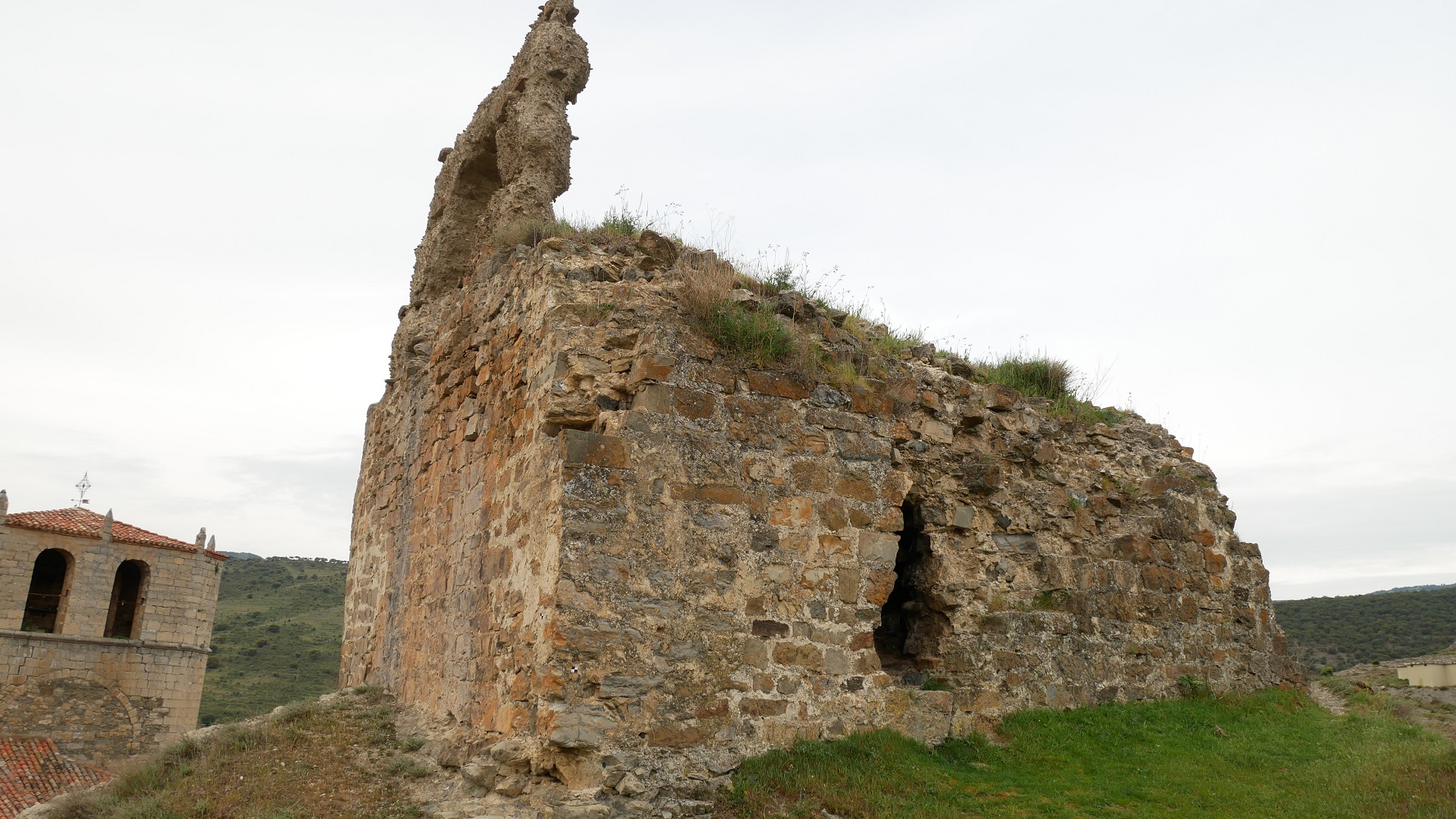
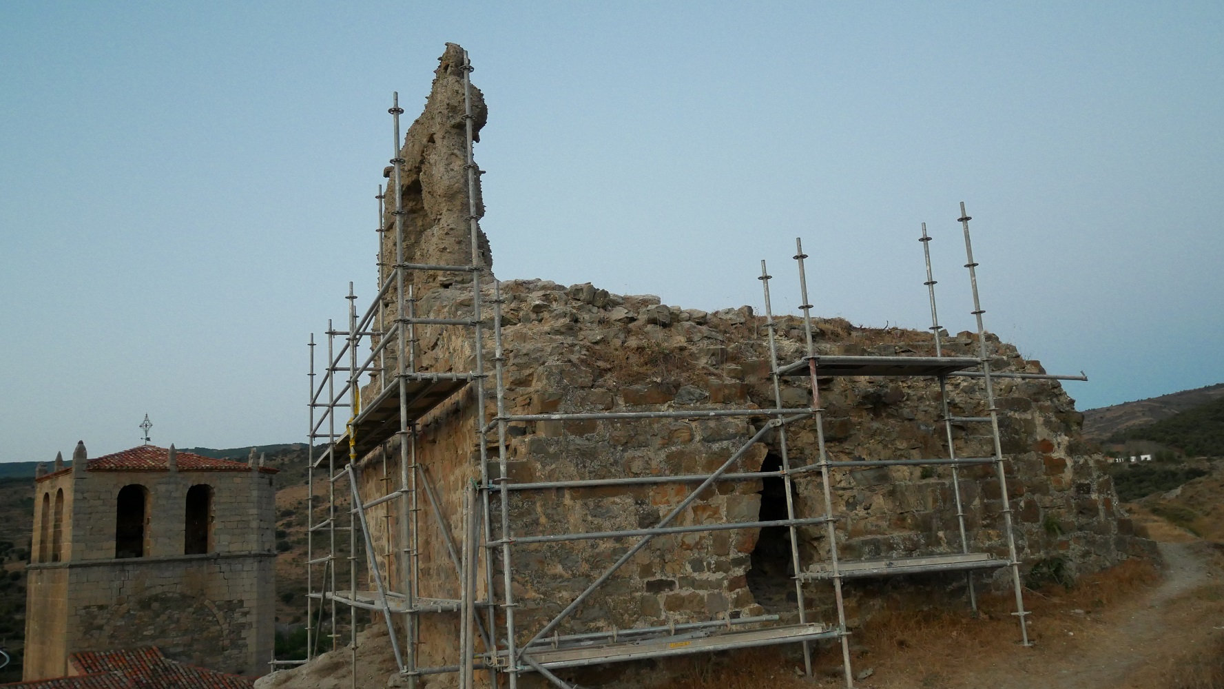
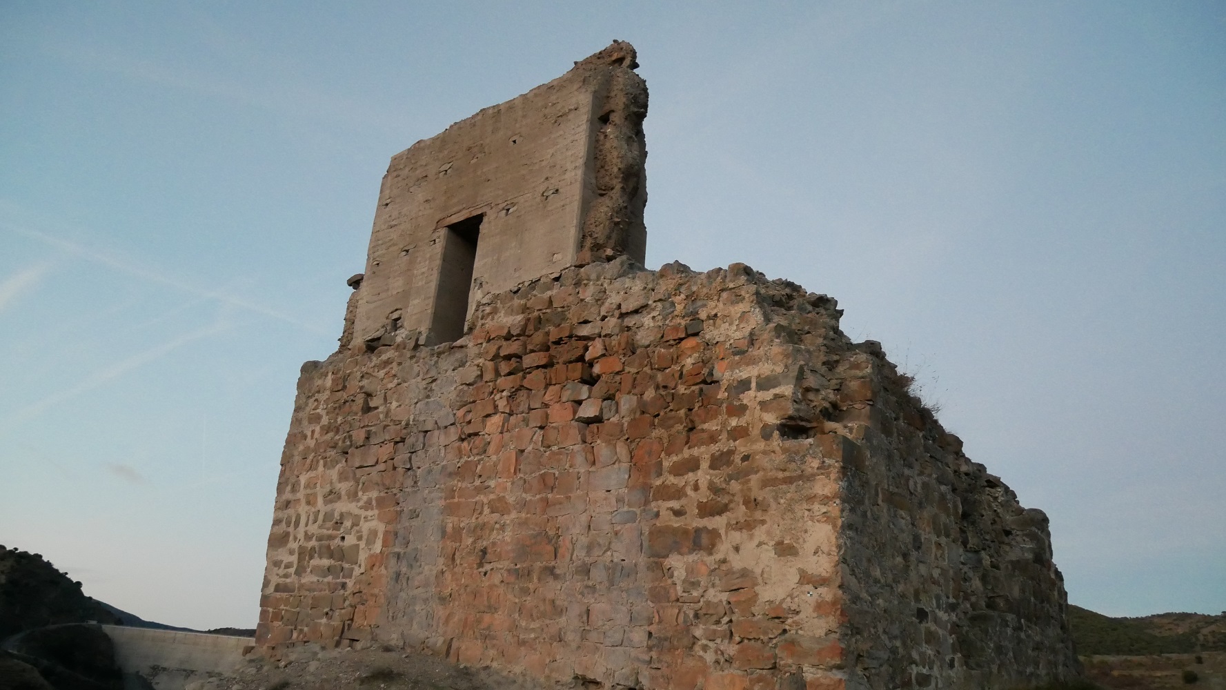
| dc.description.abstract | [ES] La parte documentada corresponde a los restos del torreón de planta aproximadamente cuadrada de unos 8 x 8 metros, una altura de unos 5 metros del cuerpo sólido y otros 4 metros los restos de la única pared que queda en pie por encima de esa cota. Se dispone de documentación previa y posterior a la intervención, realizadas mediante fotogrametría desde dron con apoyo topográfico. Este proyecto es continuación de los realizado en el muro norte y en el torreón cilíndrico y reaprovecha la base topográfica. | es_ES |
| dc.description.abstract | [EN] The part documented consists of the remains of a tower of rectangular bases (around 8 x 8 metres in plan) with an height of around 5 metres for the solid block and 4 additional metres for the only remaining wall. The geometric documentation of the surface (previously and after the consolidation works) was done by means of photogrammetry, with photographs taken from a drone. The reference network was established by means of GNSS observations and the control points were measured with total station. This project continues two previous intervention in the northern wall and in the cylindrical tower. | en |
| dc.description.sponsorship | D. Carlos Bahillo Antolín | es_ES |
| dc.description.tableofcontents | [ES] Memoria del proyecto en formato PDF (51 páginas), tres fotografías de documentación del torreón en diferentes momentos y 2 modelos 3D (formato OBJ) que muestran los estados previos y posterior a la restauración. | es_ES |
| dc.description.tableofcontents | [EN] Report with the explanation of the works in a PDF document (51 pages, in Spanish), 3 photographs (JPEG format) documenting different states of the tower over time and 2 3D models (OBJ format) with the state before and after the restoration works. | es_ES |
| dc.language.iso | spa | es_ES |
| dc.publisher | Laboratorio de Documentación Geométrica del Patrimonio (UPV/EHU) | es_ES |
| dc.rights | info:eu-repo/semantics/openAccess | es_ES |
| dc.rights.uri | http://creativecommons.org/licenses/by/3.0/es/ | * |
| dc.subject | patrimonio cultural | es_ES |
| dc.subject | ingeniería militar | es_ES |
| dc.subject | fotogrametría | es_ES |
| dc.subject | cultural heritage | en |
| dc.subject | military engineering | en |
| dc.subject | photogrammetry | en |
| dc.title | [R_Enciso_Castillo] Documentación geométrica del torreón superior, de planta prismática, del castillo de Enciso, La Rioja | es_ES |
| dc.title.alternative | Geometric documentation of upper prismatic tower of the castle of Enciso, La Rioja | en |
| dc.type | info:eu-repo/semantics/report | es_ES |
| dc.rights.holder | Laboratorio de Documentación Geométrica del Patrimonio (UPV/EHU) | es_ES |
| dc.rights.holder | Atribución 3.0 España | * |
| dc.coverage.spatiallink | http://maps.google.com/maps?q=42.1499,-2.27 | |
| dc.coverage.spatiallink | http://vocab.getty.edu/tgn/7333973 |
Files in this item
This item appears in the following Collection(s)

Except where otherwise noted, this item's license is described as Laboratorio de Documentación Geométrica del Patrimonio (UPV/EHU)